In Brief
Cowpens National Battlefield near Gaffney, South Carolina, saw a Revolutionary War rout end in under an hour. Its best-known haunting isn't an apparition but a class of schoolchildren who all smelled gunpowder at once near the tree line.
The Full Story
A school group walked the trail at Cowpens National Battlefield, near Gaffney in upstate South Carolina, and somewhere along a wooded stretch, the children started getting sick. Not one at a time. All of them, at once.
What they reported smelling was smoke. "I smelled this smoky odor that I can only equate to Gunpowder," one child said afterward. The nausea stopped, the story goes, the moment they cleared the tree line.
The gunpowder has a source. On the frozen morning of January 17, 1781, this open cattle pasture held one of the fastest and most lopsided fights of the Revolution. Brigadier General Daniel Morgan set his men in three lines, sharpshooters up front, militia in the middle, and John Eager Howard's Continental regulars as the main line behind them, then waited for Banastre Tarleton, the British cavalry officer called Bloody Ban, who had earned the name at the Waxhaws, where his men were accused of cutting down Americans as they surrendered. Morgan's militia fired two volleys and fell back as ordered. Tarleton's regulars chased the retreat straight into the trap. William Washington's cavalry swung around the flank while the Continentals turned and fired, closing on the British from both sides. Historians call it a small American Cannae.
It was over in under an hour. Roughly 86% of Tarleton's force was killed, wounded, or captured: 110 dead and more than 500 taken prisoner, against a couple dozen American dead. The place is named, plainly, for the cattle pens that once grazed on it. Cowpens was the turning point of the war in the South, and within the year Cornwallis, the general Tarleton served under, surrendered at Yorktown.
The older stories are the kind battlefields tend to grow. Locals tell of figures in Continental and British uniforms at dusk, crossing the field near the old lines and gone the moment anyone walks toward them. On quiet evenings, they say, there is musket fire and the beat of drums with no one to make either. None of it appears in a park record. It survives as oral tradition and nothing firmer.
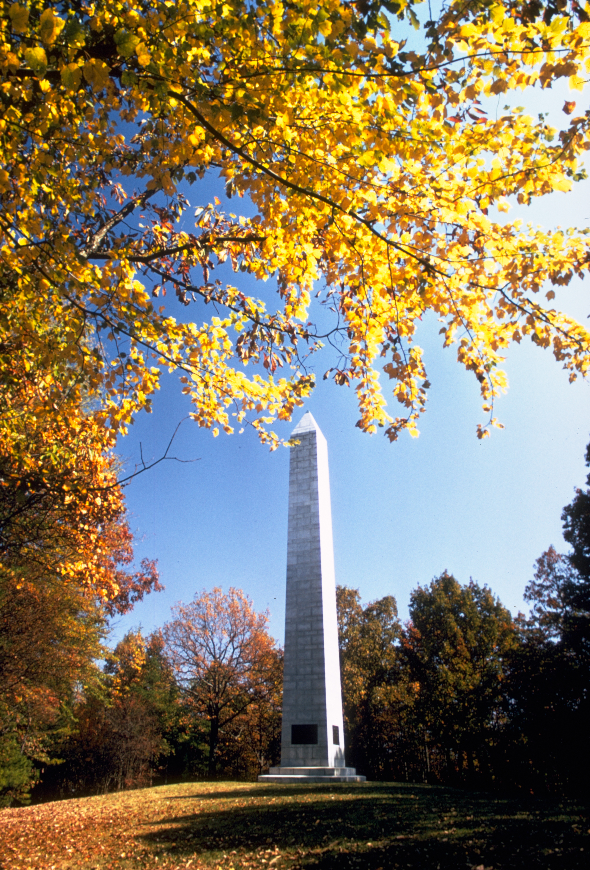
What the park does keep is the ground itself. Green River Road still runs down the center of the field, where the two lines met on it, and a 1.3-mile loop traces the old positions past the 1856 Washington Light Infantry Monument, the oldest marker on the field. The fighting lasted less than an hour, more than two centuries ago. The children smelled it anyway.